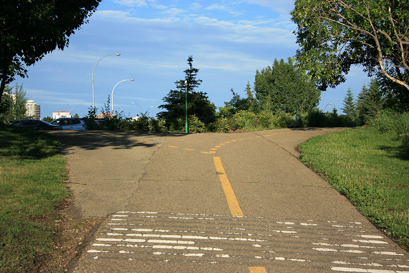
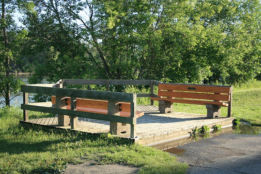
Government House Park is located at the confluence of Groat Road and River Valley Road in Edmonton. It’s most easily accessed from the north via Groat Road, but can be reached via River Valley Road and Victoria Park Road (the roads are a bit convoluted in this area, so it may be tricky, depending on your approach). Why is the park called Government House, you ask? At the top of the bank, directly north of the park, sits the Royal Alberta Museum and Government House, once the residence of Alberta’s Governor Generals, now used for government functions and special events.
The park is a well-positioned jumping off point for walking, running, and cycling. From the parking area, one can walk, run, or bike in almost any direction. MacKinnon and Ramsay ravines lie to the west. The ever-popular multi-use trail on River Valley Road stretches eastward to the Walterdale Bridge. Hawrelak and Emily Murphy Parks are easily reached via the Groat Bridge and provide access to the University and, a ways down the trail, Whitemud Park.
This hike begins at Government House Park and travels west to MacKinnon Ravine.
I recommend walking this track in the evening or morning1. There are some great photo opportunities along the way, and low light just makes everything look beautiful.
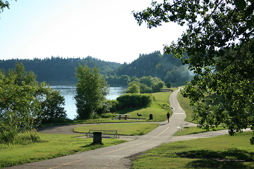
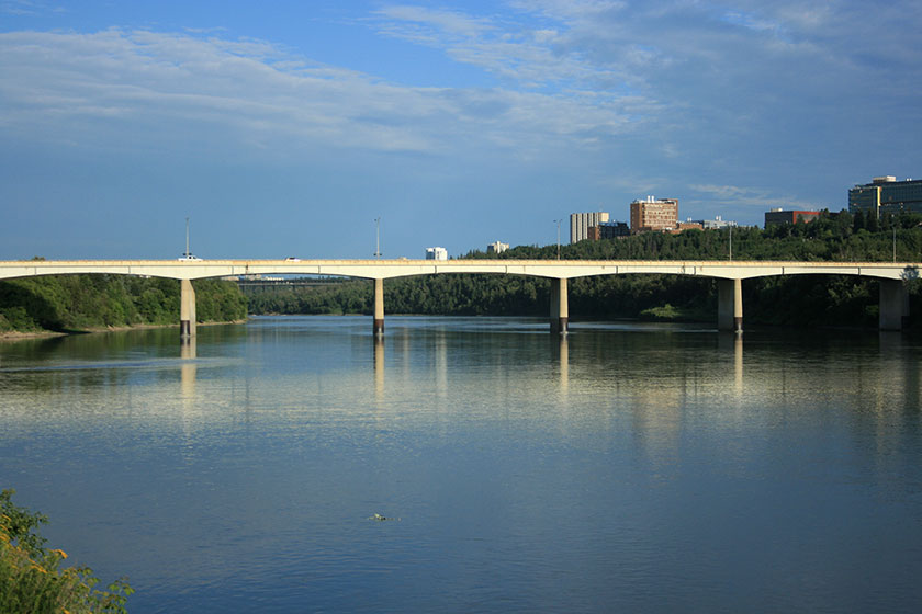
The trail from the parking area runs low and close to the river. Some days, you may even see fishermen on the riverbanks. There are numerous spots to sit and enjoy the valley, and it’s worth taking a glance back over your shoulder to admire the Groat Bridge – a plain, unassuming structure that’s easy to take for granted, but is hands down the best place in Edmonton to watch the sunrise.
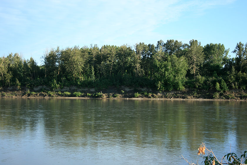
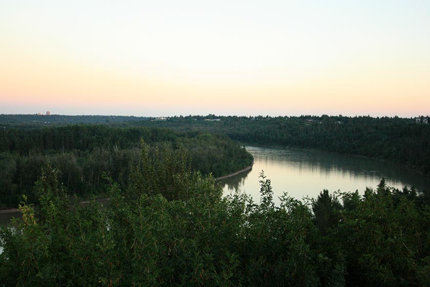
It’s also worth looking at the bank across the river, near the Mayfair Golf Course. It’s a steeply cut bank that continues around the “Hawrelak Hump”, one of the more beautiful curves in the North Saskatchewan River.
There are many beautiful spots to sit and picnic along the trail, and you’ll find people lounging about on these banks at almost any time of day.
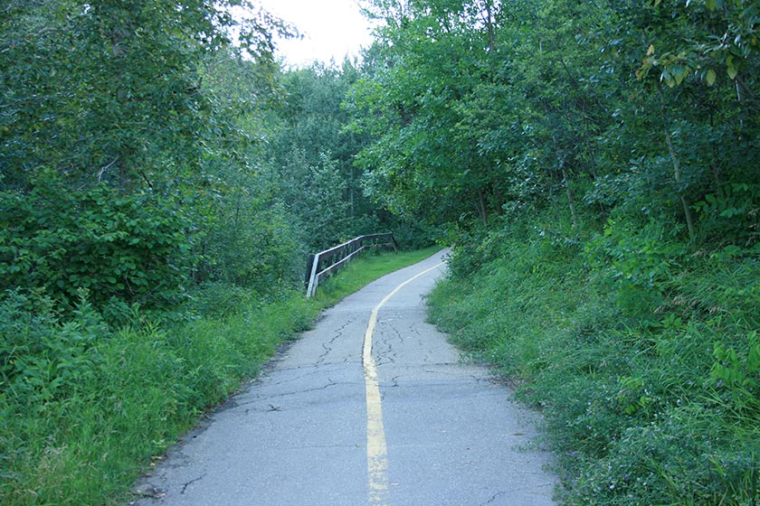
A junction with Ramsay Ravine is a few hundred meters up the trail. Ramsay Ravine juts north from the main trail. It’s a short jaunt up, and it offers access to the Glenora neighbourhood. I wouldn’t call it spectacular scenery-wise, but it has some appealing segments.
At the time of this writing, part of the trail was subject to detour due to bridge repairs and construction on 102 avenue.

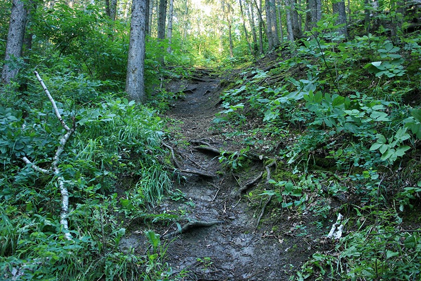
The uphill grade of Ramsay Ravine isn’t too crazy, but it does offer a light workout for those looking to step up their heart rate.
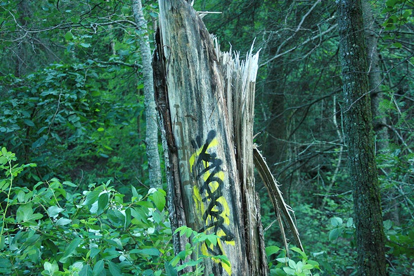
It sometimes seems as though every trail sign has been “tagged” by graffiti. I stumbled across a tree sporting a fresh tag.
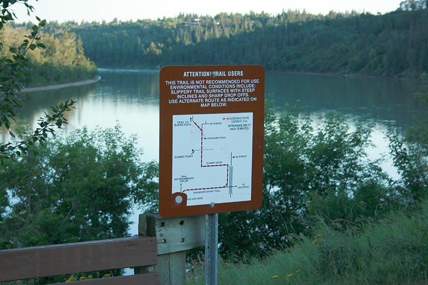
Once at the top of Ramsay, it’s cool to have a look at the exquisite houses in the area before heading back down. With Ramsay’s pleasant diversion behind, it’s only a few hundred meters to the mouth of MacKinnon Ravine. Near the entrance, there is a packed-earth trail that runs south along the bank of the river toward Buena Vista Park. Due to severe bank erosion, this trail isn’t recommended for travel and does not appear on the city’s trail maps. It is still walkable2, however, but I’ll leave that trail for a future writeup.
At this point, one enters the understated but pleasant and accessible MacKinnon Ravine. The ravine was, at one time, slated to be a freeway that ran from the west end to downtown. Luckily, this proposal was kyboshed by Edmonton City Council in 1974 (by one vote, no less!).
At the ravine’s entrance, there is a short path and stairway that climbs the ravine bank to the ultra-rich St Georges Crescent. Excellent, sweeping views of the valley can be had from this vantage, the view south being especially striking.
The ravine has been used heavily over the years, and there is evidence of (relatively) recent plantings done to increase a natural feel.
The trail climbs at a gentle grade through the ravine, slowly rising to its western terminus at 149 street. It’s accessible from the surrounding neighbourhoods at a few points along the way, mainly from Ravine Drive, which skirts the northern edge of the ravine.
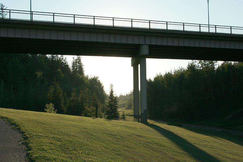
At about the halfway point, the 142st bridge appears, and with it come some great photo opportunities. I happened to be walking in the evening, and the bridge was lovely in the dramatic light.
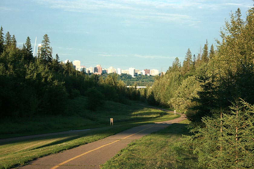
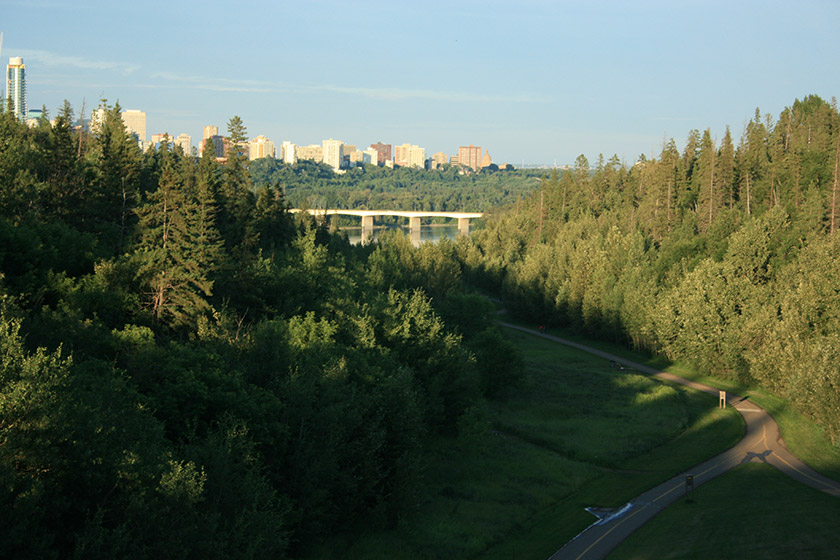
The trail continues westward, but the steep climb up to 142 street is well worth the effort. On the access path up from the ravine, be sure to look behind you for a great view of downtown.
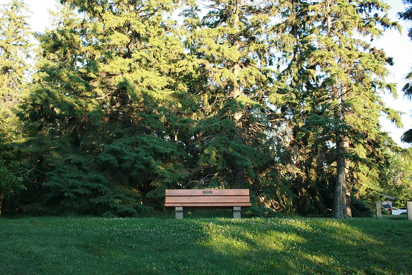
Once at the top, there is a nice sitting area recessed into the trees.
The view of downtown from the 142 street bridge is excellent, especially in the morning with the sun rising (a better photo could be had with a decent telephoto lens).
Many times in the summer months, you can catch skateboarders using the ravine for high-speed joyrides. It’s uniquely suited for the purpose – a long, paved, wide trail that flows downhill at a gentle but appreciable grade. I encountered a few surfers on my evening traverse, but none consented to a photograph.
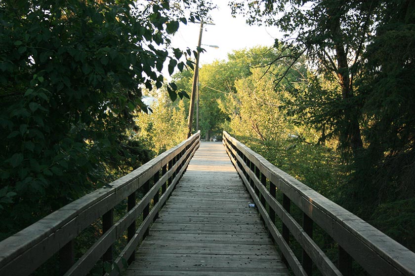
From 142 street, it’s a relatively gentle uphill push to the end of the ravine. The trail surfaces half a block east of 149 street. At this point, the ravine is accessible from Stony Plain Road via a nice wooden bridge.
Near the trailhead, and in the sinking evening light, I noticed that the power lines across the street were gently illuminated.
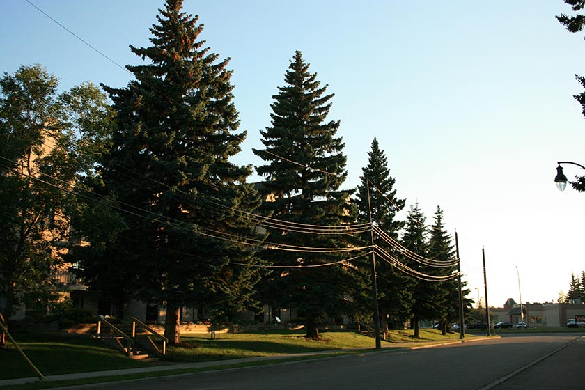
The trailhead is on 149 street, and it’s worthwhile spending a few moments there to view the lay of the roadway, and how its elevation sinks just south of Stony Plain Road, following where the ravine would have continued.

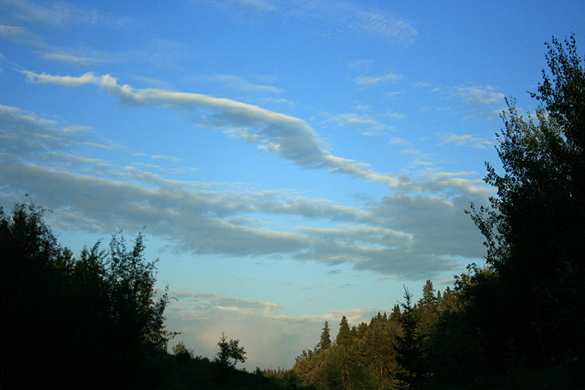
On my return traverse, I had a great view of the sky and clouds. It made for a pleasant end to this lovely walk through the central/west part of Edmonton.
This trail isn’t the most spectacular, most difficult, or most anything. It’s a simple, relatively flat, accessible walk through the river valley with easy access to hill and stair challenges. Government House Park offers a lot of scenic picnic area, and is a great launching point for a river valley jaunt. Recommended.
Notes
1 Actually, I recommend hiking all trails in the “golden hours”, i.e. the hours just before sunset and just after sunrise. ↵
2 This trail used to be official. It’s not in too bad of shape, but it is dangerous in a few spots. Hikers should be careful of uneven, unstable ground, and cyclists should probably avoid it. ↵