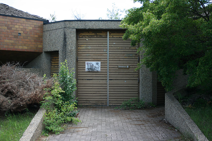
The Strathcona Science Park (SSP) was once part of the Capital City Recreation Park – an initiative launched in 1978 that joined Edmonton’s river valley into one continuous, trail-linked stretch of urban parkland, running from the Alberta legislature grounds to Hermitage Park. Now abandoned but cared for by the Province as a provincial park1, the SSP is located on 17th street, just south of Trans-Canada Highway 16 (Yellowhead). It sits across the river from the northern reaches of Rundle Park and is accessible via the Rundle Park Footbridge2. It’s also across the street from an oil refinery, which is fitting. The original purpose of the park was to educate visitors on the basics of the local energy (oil) industry, as well as illuminate some of the natural history of the area. The park’s pavilions, pathways, and amenities have been left unkempt, making it a genuine Edmonton ruin.

Most of the park signage has been left as was, and tattered flags wave at the top of rattling poles.


The layout of the park was/is interesting. It consists of four sets of octagonal pairs of pavilions, arranged in the rough shape of a sundial. The photo below was grabbed from Google Maps.


I would LOVE to explore these abandoned buildings! Between the pavilions, there was a “plaza” area with picnic tables and large, protruding concrete slabs, reminiscent of brutalist architecture3.


There is evidence of basic ongoing care – mowed lawns, new paint on picnic tables, and some parking lot maintenance. I’ve long thought it would be cool to rehabilitate this park, but its proximity to a refinery makes the prospect an unlikely one.
A paved multi-use pathway leads south from the pavilions (about 700m or so) to a long-abandoned archeological site. The area is severely overgrown and decrepit.


Near this pavilion, a boardwalk stretches out to the lip of the river bank and provides a couple of outstanding views of the valley.


The boardwalk is decrepit in places, but is in decent enough shape for a basic walk around. On the other side of the boardwalk, I had to laugh at this completely overgrown sitting area.

The trail loops back to the main pavilions, and on the way, one might catch a great shot of the vast prairie sky.

Walking the northern path loop from the main pavilions leads down to the river itself and the base of the Sunridge Ski Area, which is also an abandoned archaeological trail loop. It’s a fun walk, if you like overgrown, unused areas.


Some of the info markers have been removed but some remain, albeit with blank faces.

Parts of the return path are in exceedingly poor condition. Nonetheless, I saw fresh mountain bike tracks and recent footprints in the mud. From this point it is possible to travel south along the river’s edge, all the way to Goldbar Park via a few goat trails and the excellent Pipe Dream and Cambodia Trails4. I chose to trundle back up the hill to the bank and conclude my survey of the area.

The Strathcona Science Park is an interesting place for its history and decrepitude, and for its outstanding views of the valley. It’s a ghost from the previous century, and if you’re into abandoned places, it’s well worth the trip.
Notes
1 “No facilities onsite at park.” ↵
2 Not to be confused with the more southerly Ainsworth Dyer Bridge, which connects Rundle Park to Goldbar Park. ↵
3 As was the trend in those days. You can see this architectural style in the numerous park pavilions and obelisks in the river valley parks, not to mention Commonwealth Stadium, and many other city structures built in the late 70’s. ↵
4 Subjects of future TrailRag writeups. ↵
Additional Reading
- Here’s an interesting post from Edmonton designer Greg Whistance-Smith. He led a walking excursion through the park in 2013. Look at the booklet he designed! Wow!
- A thread on the Connect To Edmonton Forums regarding the SPP.